
Topografische kaart Mount Lamlam
Interactieve kaart
Klik op de kaart om de hoogte weer te geven.
Mount Lamlam
Rising to 406 meters (1,332 ft) above sea level, the distance from the peak to the bottom of the nearby Mariana Trench is said to be the greatest change in elevation on Earth over such a short distance.
Over deze kaart
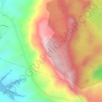
Naam: Topografische kaart Mount Lamlam, hoogte, reliëf.
Locatie: Mount Lamlam, Hågat Municipality, Guam, 96916, United States (13.33781 144.66668 13.33791 144.66678)
Gemiddelde hoogte: 223 m
Minimale hoogte: 10 m
Maximale hoogte: 395 m
Andere topografische kaarten
Klik op een kaart om zijn topografie, zijn hoogte en zijn reliëf te bekijken.