
Topografische kaart Challapalli
Interactieve kaart
Klik op de kaart om de hoogte weer te geven.
Over deze kaart
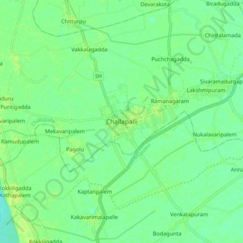
Naam: Topografische kaart Challapalli, hoogte, reliëf.
Gemiddelde hoogte: 8 m
Minimale hoogte: 1 m
Maximale hoogte: 13 m
Challapalli is located at 16°07′00″N 80°56′00″E / 16.1167°N 80.9333°E / 16.1167; 80.9333. It has an average elevation of 7 metres (23 ft). It is located 25 kilometres (16 mi) from the district headquarters, Machilipatnam, and lies on the border of the Krishna District and the Guntur District near Repalle, in the South Guntur District.
Andere topografische kaarten
Klik op een kaart om zijn topografie, zijn hoogte en zijn reliëf te bekijken.
Ramanagaram
India > Andhra Pradesh > Challapalle
Ramanagaram, Challapalle, Krishna District, Andhra Pradesh, 521126, India
Gemiddelde hoogte: 8 m