Topografische kaart Rohtang Pass
Interactieve kaart
Klik op de kaart om de hoogte weer te geven.
Over deze kaart
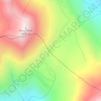
Naam: Topografische kaart Rohtang Pass, hoogte, reliëf.
Locatie: Rohtang Pass, Lahul, Lahul and Spiti, Himachal Pradesh, India (32.37095 77.24622 32.37105 77.24632)
Gemiddelde hoogte: 4.042 m
Minimale hoogte: 3.484 m
Maximale hoogte: 4.617 m
Andere topografische kaarten
Klik op een kaart om zijn topografie, zijn hoogte en zijn reliëf te bekijken.
Yamling
India > Himachal Pradesh > Lahul
Yamling, Lahul, Lahaul and Spiti District, Himachal Pradesh, India
Gemiddelde hoogte: 3.420 m
Bara Shigri Glacier
India > Himachal Pradesh > Lahul
Bara Shigri Glacier, Lahul, Lahul and Spiti, Himachal Pradesh, India
Gemiddelde hoogte: 5.369 m
Baralacha Pass
India > Himachal Pradesh > Lahul
Baralacha Pass, Lahul, Lahul and Spiti, Himachal Pradesh, India
Gemiddelde hoogte: 4.983 m
Sarchu
India > Himachal Pradesh > Lahul
Sarchu, Lahul, Lahul and Spiti, Himachal Pradesh, India
Gemiddelde hoogte: 5.408 m
Keylang
India > Himachal Pradesh > Lahul > Keylang
Keylang, Lahul, Lahul and Spiti, Himachal Pradesh, 175132, India
Gemiddelde hoogte: 3.827 m
Lahul
India > Himachal Pradesh > Lahul
Lahul, Lahul and Spiti, Himachal Pradesh, India
Gemiddelde hoogte: 4.551 m