
Topografische kaart Santa Marta do Bouro
Interactieve kaart
Klik op de kaart om de hoogte weer te geven.
Over deze kaart
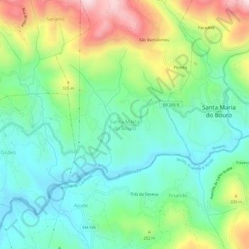
Naam: Topografische kaart Santa Marta do Bouro, hoogte, reliëf.
Locatie: Santa Marta do Bouro, Amares, Braga, 4720-633, Portugal (41.63728 -8.31023 41.67728 -8.27023)
Gemiddelde hoogte: 196 m
Minimale hoogte: 33 m
Maximale hoogte: 536 m