
Doe een donatie
Rust jezelf uit voor je volgende avontuur:
Als Amazon-partner verdient deze site een commissie op in aanmerking komende aankopen, zonder extra kosten voor jou.
Topografische kaart Kronstadt
Klik op de kaart om de hoogte weer te geven.
Doe een donatie
Rust jezelf uit voor je volgende avontuur:
Als Amazon-partner verdient deze site een commissie op in aanmerking komende aankopen, zonder extra kosten voor jou.
Kronstadt
The Kronstadt tide gauge is situated near the former Italian palace. Sea level observations in Saint Petersburg began already in 1703. On Kotlin Island, the main naval fortress of the Russian Empire began observations in 1707. This monitoring was necessary because the water level of the Finnish Gulf could change considerably in a short time, creating problems for shipping. The annual flood also required close monitoring of the water level. The Kronstadt sea-gauge with the tide gauge pavilion is the zero level of the Baltic system of highs and lows. All depths and altitudes (even the heights of spacecraft) in Russia and some other countries of the former Russian Empire are measured according to the Kronstadt sea-gauge. Yuri Gagarin, the first man in space, said in 1967 that it was "the Hub of the Universe".
Doe een donatie
Rust jezelf uit voor je volgende avontuur:
Als Amazon-partner verdient deze site een commissie op in aanmerking komende aankopen, zonder extra kosten voor jou.
Over deze kaart
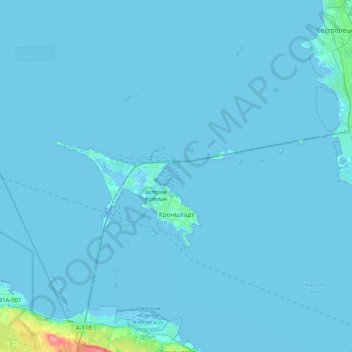
Naam: Topografische kaart Kronstadt, hoogte, reliëf.
Gemiddelde hoogte: 2 m
Minimale hoogte: -10 m
Maximale hoogte: 73 m
Doe een donatie
Rust jezelf uit voor je volgende avontuur:
Als Amazon-partner verdient deze site een commissie op in aanmerking komende aankopen, zonder extra kosten voor jou.
Andere topografische kaarten
Klik op een kaart om zijn topografie, zijn hoogte en zijn reliëf te bekijken.
Saint Petersburg
Russia > Saint Petersburg > Saint Petersburg
The elevation of Saint Petersburg ranges from the sea level to its highest point of 175.9 m (577 ft) at the Orekhovaya Hill in the Duderhof Heights in the south. Part of the city's territory west of Liteyny Prospekt is no higher than 4 m (13 ft) above sea level, and has suffered from numerous floods. Floods in…
Gemiddelde hoogte: 14 m