
Topografische kaart Żuławy
Interactieve kaart
Klik op de kaart om de hoogte weer te geven.
Over deze kaart
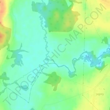
Naam: Topografische kaart Żuławy, hoogte, reliëf.
Gemiddelde hoogte: 80 m
Minimale hoogte: 66 m
Maximale hoogte: 102 m
Andere topografische kaarten
Klik op een kaart om zijn topografie, zijn hoogte en zijn reliëf te bekijken.
Różyna
Poland > Warmian-Masurian Voivodeship > Bartoszyce County
Różyna, gmina Sępopol, Bartoszyce County, Warmian-Masurian Voivodeship, 11-210, Poland
Gemiddelde hoogte: 41 m
Żydowo
Poland > Warmian-Masurian Voivodeship > Bartoszyce County
Żydowo, gmina Bartoszyce, Bartoszyce County, Warmian-Masurian Voivodeship, 11-200, Poland
Gemiddelde hoogte: 80 m