
Topografische kaart Draper
Interactieve kaart
Klik op de kaart om de hoogte weer te geven.
Draper
Draper's climate is roughly identical to that of other Salt Lake City suburbs. However, due to being further away from the Great Salt Lake, varied elevation, and from the downtown urban heat island effect, Draper experiences a slightly drier winter, and more extremes in temperatures.
Over deze kaart
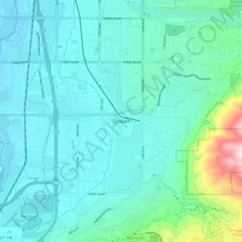
Naam: Topografische kaart Draper, hoogte, reliëf.
Locatie: Draper, Salt Lake County, Utah, 84020, United States (40.48478 -111.90280 40.56478 -111.82280)
Gemiddelde hoogte: 1.464 m
Minimale hoogte: 1.313 m
Maximale hoogte: 2.333 m