
Topografische kaart Village of Cayuga Heights
Interactieve kaart
Klik op de kaart om de hoogte weer te geven.
Over deze kaart
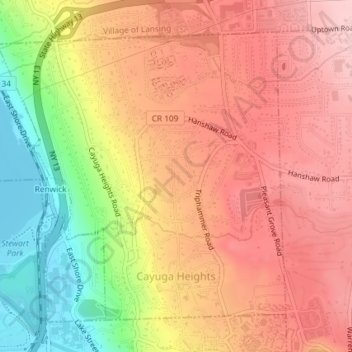
Naam: Topografische kaart Village of Cayuga Heights, hoogte, reliëf.
Gemiddelde hoogte: 234 m
Minimale hoogte: 114 m
Maximale hoogte: 311 m
Cayuga Heights is located at 42°27′59″N 76°29′19″W / 42.466338°N 76.488678°W / 42.466338; -76.488678 (42.466338, -76.488678), on the eastern slope of Cayuga Lake. The elevation ranges from 900 feet near the Community Corners to 400 feet near the lake. Several streams and steep gorges cut through the village.