
Topografische kaart Qalb Lawzah
Interactieve kaart
Klik op de kaart om de hoogte weer te geven.
Over deze kaart
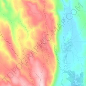
Naam: Topografische kaart Qalb Lawzah, hoogte, reliëf.
Gemiddelde hoogte: 590 m
Minimale hoogte: 450 m
Maximale hoogte: 729 m
Qalb Loze lies at an elevation of 670 meters in the Idlib Governorate on the A'la Mountain (Jabal Summaq) plateau, a remote hilly region of western central part of the northern Syrian limestone massif, a few kilometers from the Turkish border. The place is near Barisha and is accessible from the main Aleppo-Antakya road by a secondary road that heads northeast. Nearby localities include Qurqania to the south, Kafr Dariyan to the east and Kafr Takharim to the west.