
Topografische kaart Ghuttu
Interactieve kaart
Klik op de kaart om de hoogte weer te geven.
Over deze kaart
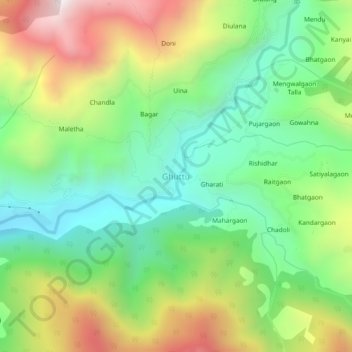
Naam: Topografische kaart Ghuttu, hoogte, reliëf.
Locatie: Ghuttu, Ghansali, Tehri Garhwal District, Uttarakhand, India (30.50890 78.77015 30.54890 78.81015)
Gemiddelde hoogte: 1.856 m
Minimale hoogte: 1.437 m
Maximale hoogte: 2.542 m
Andere topografische kaarten
Klik op een kaart om zijn topografie, zijn hoogte en zijn reliëf te bekijken.
Budha Kedar
India > Uttarakhand > Ghansali
Budha Kedar, Ghansali, Tehri Garhwal District, Uttarakhand, 249125, India
Gemiddelde hoogte: 1.644 m