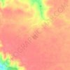
Topografische kaart Luseland
Klik op de kaart om de hoogte weer te geven.
Over deze kaart

Naam: Topografische kaart Luseland, hoogte, reliëf.
Locatie: Luseland, Saskatchewan, S0L 2A0, Canada (52.07414 -109.40316 52.08526 -109.37798)
Gemiddelde hoogte: 701 m
Minimale hoogte: 683 m
Maximale hoogte: 725 m
Andere topografische kaarten
Klik op een kaart om zijn topografie, zijn hoogte en zijn reliëf te bekijken.














Buffalo Pound Provincial Park
Canada > Saskatchewan > Marquis No. 191
Nicolle Flats Marsh, with a total area of 73.18 km2 (28.25 sq mi) and an elevation of 511 m (1,677 ft), is a large marshy area located in the park at the south-east corner of Buffalo Pound Lake. The confluence of the Qu'Appelle and Moose Jaw Rivers is in the marsh. The area is an Important Bird Area of Canada…
Gemiddelde hoogte: 572 m

McClean Lake
Canada > Saskatchewan > Division No. 18 > Unorganized Division No. 18
Gemiddelde hoogte: 440 m


Sipanok Channel
Canada > Saskatchewan > Division No. 18 > Unorganized Division No. 18
Gemiddelde hoogte: 277 m


















La Loche
Canada > Saskatchewan > Northern Saskatchewan Administration District > La Loche
Gemiddelde hoogte: 447 m