
Topografische kaart Maryand
Interactieve kaart
Klik op de kaart om de hoogte weer te geven.
Over deze kaart
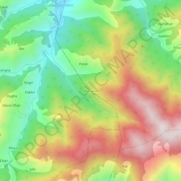
Naam: Topografische kaart Maryand, hoogte, reliëf.
Locatie: Maryand, Banjar, Kullu, Himachal Pradesh, India (31.52355 77.28917 31.56355 77.32917)
Gemiddelde hoogte: 2.732 m
Minimale hoogte: 2.343 m
Maximale hoogte: 3.203 m