
Topografische kaart Podia
Interactieve kaart
Klik op de kaart om de hoogte weer te geven.
Over deze kaart
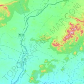
Naam: Topografische kaart Podia, hoogte, reliëf.
Locatie: Podia, Malkangiri, Orissa, India (18.05660 81.50725 18.32157 81.72468)
Gemiddelde hoogte: 180 m
Minimale hoogte: 88 m
Maximale hoogte: 650 m