
Topografische kaart Fanling
Interactieve kaart
Klik op de kaart om de hoogte weer te geven.
Over deze kaart
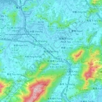
Naam: Topografische kaart Fanling, hoogte, reliëf.
Locatie: Fanling, North District, New Territories, Hong Kong, China (22.45463 114.09827 22.53463 114.17827)
Gemiddelde hoogte: 73 m
Minimale hoogte: -2 m
Maximale hoogte: 477 m