
Topografische kaart Vierville
Klik op de kaart om de hoogte weer te geven.
Over deze kaart
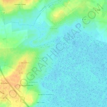
Naam: Topografische kaart Vierville, hoogte, reliëf.
Gemiddelde hoogte: 10 m
Minimale hoogte: -1 m
Maximale hoogte: 35 m
Andere topografische kaarten
Klik op een kaart om zijn topografie, zijn hoogte en zijn reliëf te bekijken.
Le Haut de l'Amont
France > Normandie > Manche > Carentan-les-Marais > Saint-Côme-du-Mont
Gemiddelde hoogte: 7 m
Le Mitouflard
France > Normandie > Manche > Carentan-les-Marais > Saint-Côme-du-Mont
Gemiddelde hoogte: 10 m