
Topografische kaart Bear Paw State Natural Area
Interactieve kaart
Klik op de kaart om de hoogte weer te geven.
Over deze kaart
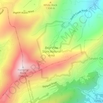
Naam: Topografische kaart Bear Paw State Natural Area, hoogte, reliëf.
Gemiddelde hoogte: 1.249 m
Minimale hoogte: 962 m
Maximale hoogte: 1.557 m