
Topografische kaart Guadalupe Ocotán
Interactieve kaart
Klik op de kaart om de hoogte weer te geven.
Over deze kaart
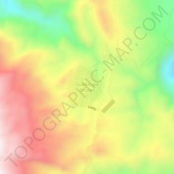
Naam: Topografische kaart Guadalupe Ocotán, hoogte, reliëf.
Locatie: Guadalupe Ocotán, La Yesca, Nayarit, 63582, México (21.86982 -104.37510 21.90982 -104.33510)
Gemiddelde hoogte: 1.101 m
Minimale hoogte: 644 m
Maximale hoogte: 1.518 m