Topografische kaart Delhi
Klik op de kaart om de hoogte weer te geven.
Delhi
There is a valley that spans a distance of 5 kilometres or 3.1 miles between Delhi and Lynedoch that contains remnants of Ontario's original old-growth Carolinian forest, adding up to just over 1 square mile (2.6 km2). The major highway route connecting this community to Port Talbot was constructed primarily on an old Aboriginal trail. Delhi remained isolated from the rest of Southwestern Ontario until 1816, when Colonel Thomas Talbot directed the surveyor to build the Talbot Trail on higher elevation land to avoid swampy marshland. This decision led to the irregular and winding route to Aylmer that Ontario Highway 3 is today. Most of Delhi was basically a dense forest until the first generation European settlers came in to build farms and mills during the 1820s. Swamps can be seen within the lower elevation portions of the region, while Big Otter Creek is located in close proximity to the downtown core.
Over deze kaart
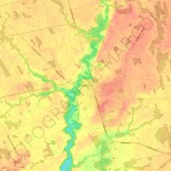
Naam: Topografische kaart Delhi, hoogte, reliëf.
Gemiddelde hoogte: 237 m
Minimale hoogte: 202 m
Maximale hoogte: 250 m
Andere topografische kaarten
Klik op een kaart om zijn topografie, zijn hoogte en zijn reliëf te bekijken.


Turkey Point Provincial Park
Canada > Ontario > Norfolk County > Turkey Point
Gemiddelde hoogte: 192 m