
Topografische kaart Guachucal
Interactieve kaart
Klik op de kaart om de hoogte weer te geven.
Over deze kaart
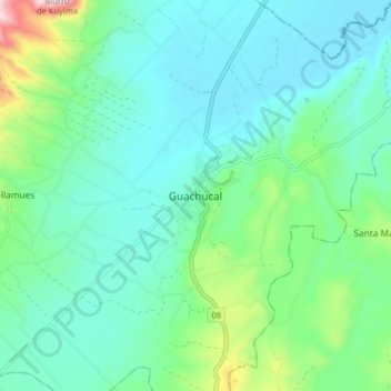
Naam: Topografische kaart Guachucal, hoogte, reliëf.
Locatie: Guachucal, Nariño, Colombia (0.91734 -77.77336 0.99734 -77.69336)
Gemiddelde hoogte: 3.116 m
Minimale hoogte: 3.005 m
Maximale hoogte: 3.543 m
Andere topografische kaarten
Klik op een kaart om zijn topografie, zijn hoogte en zijn reliëf te bekijken.