
Doe een donatie
Rust jezelf uit voor je volgende avontuur:
Als Amazon-partner verdient deze site een commissie op in aanmerking komende aankopen, zonder extra kosten voor jou.
Topografische kaart Indian Springs
Klik op de kaart om de hoogte weer te geven.
Doe een donatie
Rust jezelf uit voor je volgende avontuur:
Als Amazon-partner verdient deze site een commissie op in aanmerking komende aankopen, zonder extra kosten voor jou.
Indian Springs
One year later, Indian Springs was reactivated as Indian Springs Air Force Base by the new United States Air Force, with a new role as a new weapons systems and aircraft research and testing. Among these missions were support for nuclear arms testing at the Nevada Proving Grounds, high-altitude balloon search and retrieval, new gunnery and rocketry systems, and testing of experimental aircraft. For a period of the 1950s and 1960s Indian Springs AFB housed some of the most advanced aircraft and air weapons systems in the world.
Doe een donatie
Rust jezelf uit voor je volgende avontuur:
Als Amazon-partner verdient deze site een commissie op in aanmerking komende aankopen, zonder extra kosten voor jou.
Over deze kaart
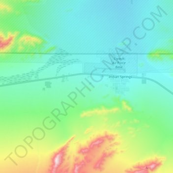
Naam: Topografische kaart Indian Springs, hoogte, reliëf.
Locatie: Indian Springs, Clark County, Nevada, United States (36.54362 -115.80646 36.59616 -115.63600)
Gemiddelde hoogte: 1.078 m
Minimale hoogte: 930 m
Maximale hoogte: 1.592 m
Doe een donatie
Rust jezelf uit voor je volgende avontuur:
Als Amazon-partner verdient deze site een commissie op in aanmerking komende aankopen, zonder extra kosten voor jou.