
Topografische kaart Sanger
Interactieve kaart
Klik op de kaart om de hoogte weer te geven.
Sanger
Sanger is a city in Fresno County, California, United States. The population was 24,270 at the 2010 census, up from 18,731 at the 2000 census. Sanger is located 13 miles (21 km) east-southeast of Fresno, at an elevation of 371 feet (113 m).
Over deze kaart
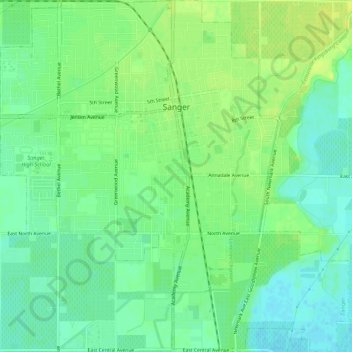
Naam: Topografische kaart Sanger, hoogte, reliëf.
Gemiddelde hoogte: 111 m
Minimale hoogte: 102 m
Maximale hoogte: 120 m