Geolokaliseren

Topografische kaart MacDonnell Ranges

Klik op de kaart om de hoogte weer te geven.

MacDonnell Ranges

The highest peaks are Mount Zeil with an elevation of 1,531 metres (5,023 ft) AHD, Mount Liebig at 1,524 metres (5,000 ft) AHD, Mount Edward at 1,423 metres (4,669 ft), Mount Giles at 1,389 metres (4,557 ft) and Mount Sonder at 1,380 metres (4,530 ft) AHD; the five highest mountains in the Northern Territory. The headwaters of the Todd, Finke and Sandover rivers form in the MacDonnell Ranges. The range is crossed by the Australian Overland Telegraph Line, the Stuart Highway and the Adelaide–Darwin rail corridor at the Heavitree Gap, a water gap created by the Todd River, at the southern entrance to Alice Springs.

Wikipedia (CC-BY-SA 3.0)

Over deze kaart

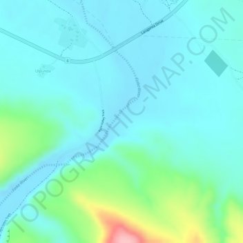
Naam: Topografische kaart MacDonnell Ranges, hoogte, reliëf.

Locatie: MacDonnell Ranges, Macdonnell Region, Northern Territory, Australia (-23.96031 132.77570 -23.96021 132.77580)

Gemiddelde hoogte: 594 m

Minimale hoogte: 562 m

Maximale hoogte: 715 m

👉 Easily get elevation data in JSON, GeoTIFF and KML formats using Elevation API
Bedankt voor het steunen van deze site ❤️
Doe een donatie

Rust jezelf uit voor je volgende avontuur:

Als Amazon-partner verdient deze site een commissie op in aanmerking komende aankopen, zonder extra kosten voor jou.

Andere topografische kaarten

Klik op een kaart om zijn topografie, zijn hoogte en zijn reliëf te bekijken.

Sydney

Australia > New South Wales

Sydney's topography is characterized by a diverse landscape that seamlessly blends coastal features with inland plateaus. The city is divided into two primary regions: the relatively flat Cumberland Plain to the south and west of Sydney Harbour, and the elevated Hornsby Plateau to the north. The Cumberland…

Gemiddelde hoogte: 53 m

City of Melbourne

Australia > Victoria

Melbourne's topography is characterized by a diverse landscape that transitions from flat coastal plains to rolling hills and mountainous regions. The city is situated at the northern end of Port Phillip Bay, where the terrain is predominantly flat, facilitating urban development. As one moves eastward, the…

Gemiddelde hoogte: 18 m

Victoria

Australia

Victoria, Australia, exhibits a remarkably varied topography shaped by the Great Dividing Range, which forms a west-to-east spine across the state. In the northeast, the Victorian Alps rise to the state’s highest point, Mount Bogong at 1,986 meters, amid deep valleys and snow-capped ridges, while westward,…

Gemiddelde hoogte: 179 m

New South Wales

Australia

New South Wales (NSW), located on Australia's eastern seaboard, boasts a diverse topography that significantly influences its landscapes and ecosystems. The state's eastern edge is dominated by a narrow coastal plain, featuring regions such as the Illawarra and Shoalhaven near Nowra, characterized by rolling…

Gemiddelde hoogte: 154 m

Bedankt voor het steunen van deze site ❤️
Doe een donatie

Rust jezelf uit voor je volgende avontuur:

Als Amazon-partner verdient deze site een commissie op in aanmerking komende aankopen, zonder extra kosten voor jou.

South Australia

Australia

Gemiddelde hoogte: 110 m

Queensland

Australia

Queensland's topography is characterized by a diverse landscape that includes coastal plains, mountain ranges, plateaus, and expansive inland areas. The Great Dividing Range runs parallel to the state's eastern coast, forming a series of mountain ranges, plateaus, and upland areas. This range influences the…

Gemiddelde hoogte: 122 m

New South Wales

Australia

New South Wales (NSW), located on Australia's eastern seaboard, boasts a diverse topography that significantly influences its landscapes and ecosystems. The state's eastern edge is dominated by a narrow coastal plain, featuring regions such as the Illawarra and Shoalhaven near Nowra, characterized by rolling…

Gemiddelde hoogte: 154 m

Melbourne

Australia > Victoria

Melbourne is also prone to isolated convective showers forming when a cold pool crosses the state, especially if there is considerable daytime heating. These showers are often heavy and can include hail, squalls, and significant drops in temperature, but they often pass through very quickly with a rapid…

Gemiddelde hoogte: 185 m

Bedankt voor het steunen van deze site ❤️
Doe een donatie

Rust jezelf uit voor je volgende avontuur:

Als Amazon-partner verdient deze site een commissie op in aanmerking komende aankopen, zonder extra kosten voor jou.

Great Dividing Range

Australia

The Great Dividing Range, also known as the East Australian Cordillera or the Eastern Highlands, is a cordillera system in eastern Australia consisting of an expansive collection of mountain ranges, plateaus and rolling hills, that runs roughly parallel to the east coast of Australia and forms the…

Gemiddelde hoogte: 117 m

Tasmania

Australia > Tasmania

The most mountainous region is the Central Highlands area, which covers most of the central western parts of the state. The Midlands located in the central east, is fairly flat, and is predominantly used for agriculture, although farming activity is scattered throughout the state. Tasmania's tallest mountain…

Gemiddelde hoogte: 220 m

Western Australia

Australia

Because the only mountain-building since then has been of the Stirling Range with the rifting from Antarctica, the land is extremely eroded and ancient, with no part of the state above 1,245 metres (4,085 ft) AHD (at Mount Meharry in the Hamersley Range of the Pilbara region). Most of the state is a low…

Gemiddelde hoogte: 194 m

City of Brisbane

Australia > Queensland

Brisbane's topography is characterized by a series of hills and ranges that define its landscape. The city is situated on a low-lying floodplain, with the Brisbane River meandering through its heart, creating a winding course with many steep curves from the southwest to its mouth at Moreton Bay in the east.…

Gemiddelde hoogte: 71 m

Melbourne

Australia > Victoria

Melbourne is also prone to isolated convective showers forming when a cold pool crosses the state, especially if there is considerable daytime heating. These showers are often heavy and can include hail, squalls, and significant drops in temperature, but they often pass through very quickly with a rapid…

Gemiddelde hoogte: 185 m

Warragamba Dam

Australia > New South Wales > Sydney > Warragamba

Gemiddelde hoogte: 156 m

Newcastle

Australia > New South Wales

Gemiddelde hoogte: 5 m

Deception Bay

Australia > Queensland

Gemiddelde hoogte: 9 m

Bexhill

Australia > New South Wales

Gemiddelde hoogte: 34 m

Ipswich City

Australia > Queensland

Gemiddelde hoogte: 84 m

Highton

Australia > Victoria

Gemiddelde hoogte: 52 m

Armidale

Australia > New South Wales

Gemiddelde hoogte: 1.036 m

Crows Nest

Australia > Queensland

Gemiddelde hoogte: 591 m

Grafton

Australia > New South Wales

Gemiddelde hoogte: 5 m

Gold Coast City

Australia > Queensland

Gemiddelde hoogte: 87 m

Sunshine Coast Regional

Australia > Queensland

The Sunshine Coast Regional area in Queensland, Australia, features a diverse topography that ranges from coastal plains to rugged hinterlands. Along the coastline, the terrain is predominantly flat, with average elevations around 20 meters (66 feet) above sea level. Inland, the landscape transitions to…

Gemiddelde hoogte: 56 m

Shire of Nannup

Australia > Western Australia

Gemiddelde hoogte: 127 m

Tweed Shire Council

Australia > New South Wales

Gemiddelde hoogte: 212 m

Goulburn

Australia > New South Wales

Owing to its elevation, Goulburn has an oceanic climate (Cfb) with warm summers and cool winters; with a high diurnal range. Its climate is variable much of the year, though generally dry with maximum temperatures ranging from 11.8 °C (53.2 °F) in July to 28.3 °C (82.9 °F) in January. Rainfall is…

Gemiddelde hoogte: 666 m

East Arnhem

Australia

Gemiddelde hoogte: 34 m

Central Desert Region

Australia

Gemiddelde hoogte: 416 m

Carwoola

Australia > New South Wales

Gemiddelde hoogte: 780 m

Adelaide

Australia > South Australia > Adelaide City Council

South Australia was officially established as a British Province in England in February 1836. The first governor proclaimed the commencement of colonial government in South Australia on 28 December 1836, near The Old Gum Tree in what is now the suburb of Glenelg North. The event is commemorated in South…

Gemiddelde hoogte: 146 m

Coraki

Australia > New South Wales

Gemiddelde hoogte: 6 m

Bedankt voor het steunen van deze site ❤️
Doe een donatie

Rust jezelf uit voor je volgende avontuur:

Als Amazon-partner verdient deze site een commissie op in aanmerking komende aankopen, zonder extra kosten voor jou.

Mount Martha

Australia > Victoria

Gemiddelde hoogte: 40 m

Maldon

Australia > Victoria

Gemiddelde hoogte: 309 m

Margaret River

Australia > Western Australia

Gemiddelde hoogte: 89 m

Mullaway

Australia > New South Wales

Gemiddelde hoogte: 10 m

Alkimos

Australia > Western Australia

Gemiddelde hoogte: 31 m

Lockyer Valley Regional

Australia > Queensland

Gemiddelde hoogte: 360 m

Bedankt voor het steunen van deze site ❤️
Doe een donatie

Rust jezelf uit voor je volgende avontuur:

Als Amazon-partner verdient deze site een commissie op in aanmerking komende aankopen, zonder extra kosten voor jou.

Wooroloo

Australia > Western Australia

Gemiddelde hoogte: 273 m

Daintree Rainforest

Australia > Queensland

Gemiddelde hoogte: 59 m

Brisbane River

Australia > Queensland

The RAAF also perform a practice session in the days preceding the event, serving as an opportunity to both practice beforehand and also promote Riverfire. One of the most popular RAAF aircraft to perform at Riverfire was the F-111 which was known for performing a 'dump-and-burn' above the city. The final…

Gemiddelde hoogte: 235 m

Gippsland

Australia > Victoria

Gemiddelde hoogte: 273 m

Bedankt voor het steunen van deze site ❤️
Doe een donatie

Rust jezelf uit voor je volgende avontuur:

Als Amazon-partner verdient deze site een commissie op in aanmerking komende aankopen, zonder extra kosten voor jou.

Taree

Australia > New South Wales

Gemiddelde hoogte: 17 m

Parramatta

Australia > New South Wales

Gemiddelde hoogte: 22 m

Bedankt voor het steunen van deze site ❤️
Doe een donatie

Rust jezelf uit voor je volgende avontuur:

Als Amazon-partner verdient deze site een commissie op in aanmerking komende aankopen, zonder extra kosten voor jou.

Wonga Park

Australia > Victoria

Gemiddelde hoogte: 91 m

Berrybank

Australia > Victoria

Gemiddelde hoogte: 163 m

Howqua River

Australia > Victoria

Gemiddelde hoogte: 773 m

Taylors Flat

Australia > New South Wales

Gemiddelde hoogte: 555 m

Calder

Australia > Tasmania

Gemiddelde hoogte: 193 m

Eneabba

Australia > Western Australia

Gemiddelde hoogte: 145 m

Mumbulla Mountain

Australia > New South Wales

Gemiddelde hoogte: 235 m

Ringtail Creek

Australia > Queensland

Gemiddelde hoogte: 54 m

Kuttabul

Australia > Queensland

Gemiddelde hoogte: 92 m

Wyee Point

Australia > New South Wales

Gemiddelde hoogte: 7 m

Katanning

Australia > Western Australia

Katanning railway station has an elevation of 1,024 feet (312 m) above sea level and a rail distance of 225 miles (362 km) from Perth.

Gemiddelde hoogte: 323 m

Port Lincoln

Australia > South Australia

Gemiddelde hoogte: 42 m

Wilsons River

Australia > New South Wales

Gemiddelde hoogte: 84 m

Blue Knob

Australia > New South Wales

Gemiddelde hoogte: 228 m

Borroloola

Australia

The Borroloola Airport has a 1,149-metre long runway at an elevation of 55 feet (16.8 metres). The airport can be very busy during the day and the occasional Careflight services the town during the night. One single-engine Cessna 210 aircraft from Katherine Aviation is based at the airport permanently. It…

Gemiddelde hoogte: 21 m

Berrima

Australia > New South Wales

Gemiddelde hoogte: 691 m

Bedankt voor het steunen van deze site ❤️
Doe een donatie

Rust jezelf uit voor je volgende avontuur:

Als Amazon-partner verdient deze site een commissie op in aanmerking komende aankopen, zonder extra kosten voor jou.

Beenleigh

Australia > Queensland

Gemiddelde hoogte: 22 m

Upper Mount Gravatt

Australia > Queensland

Gemiddelde hoogte: 61 m

Brisbane

Australia > Queensland

Gemiddelde hoogte: 87 m

Safety Bay

Australia > Western Australia

Gemiddelde hoogte: 3 m

Murrurundi

Australia > New South Wales

Gemiddelde hoogte: 641 m

Bermagui

Australia > New South Wales

Gemiddelde hoogte: 13 m

Victoria Point

Australia > Queensland

Gemiddelde hoogte: 8 m

Banana Shire

Australia > Queensland

Gemiddelde hoogte: 269 m

Durong

Australia > Queensland

Gemiddelde hoogte: 376 m

Strzelecki

Australia > Victoria

Gemiddelde hoogte: 233 m

Warner

Australia > Queensland

Gemiddelde hoogte: 45 m

Burpengary

Australia > Queensland

Gemiddelde hoogte: 26 m

City of Subiaco

Australia > Western Australia

Gemiddelde hoogte: 29 m

Bedankt voor het steunen van deze site ❤️
Doe een donatie

Rust jezelf uit voor je volgende avontuur:

Als Amazon-partner verdient deze site een commissie op in aanmerking komende aankopen, zonder extra kosten voor jou.

Upper North Shore

Australia > New South Wales > Sydney

Gemiddelde hoogte: 119 m

Orange

Australia > New South Wales

Orange is a city in the Central Tablelands region of New South Wales, Australia. It is 254 km (158 mi) west of the state capital, Sydney [206 km (128 mi) on a great circle], at an altitude of 862 metres (2,828 ft). Orange had an estimated urban population of 40,493 as of June 2018 making the city a significant…

Gemiddelde hoogte: 852 m

Upper Scamander

Australia > Tasmania

Gemiddelde hoogte: 125 m

Ruffey Lake Park

Australia > Victoria > Melbourne

Gemiddelde hoogte: 89 m

Bedankt voor het steunen van deze site ❤️
Doe een donatie

Rust jezelf uit voor je volgende avontuur:

Als Amazon-partner verdient deze site een commissie op in aanmerking komende aankopen, zonder extra kosten voor jou.

Daylesford

Australia > Victoria

Gemiddelde hoogte: 587 m

D'Aguilar National Park

Australia > Queensland

Gemiddelde hoogte: 139 m

Colebee

Australia > New South Wales

Gemiddelde hoogte: 36 m

Tocumwal

Australia > New South Wales

Gemiddelde hoogte: 112 m

Bredbo

Australia > New South Wales

Gemiddelde hoogte: 929 m

Bedankt voor het steunen van deze site ❤️
Doe een donatie

Rust jezelf uit voor je volgende avontuur:

Als Amazon-partner verdient deze site een commissie op in aanmerking komende aankopen, zonder extra kosten voor jou.

Epping

Australia > New South Wales

Gemiddelde hoogte: 96 m

Clifton Hill

Australia > Victoria

Gemiddelde hoogte: 32 m

Moree

Australia > New South Wales

Gemiddelde hoogte: 216 m

Glen Innes

Australia > New South Wales

Gemiddelde hoogte: 1.083 m

Bedankt voor het steunen van deze site ❤️
Doe een donatie

Rust jezelf uit voor je volgende avontuur:

Als Amazon-partner verdient deze site een commissie op in aanmerking komende aankopen, zonder extra kosten voor jou.

Rust jezelf uit voor je volgende avontuur:

🪜Klimuitrusting - Essentiële gear voor bergactiviteiten
👣Gel-inlegzolen - Extra demping voor gevoelige voeten
🔥Camping Kooktoestellen - Warm eten onderweg tijdens hikes
💧Herbruikbare Waterflessen - Hydratatie voor onderweg, milieuvriendelijk en licht
🧤Waterdichte Handschoenen - Bescherming tegen regen en sneeuw

Als Amazon-partner verdient deze site een commissie op in aanmerking komende aankopen, zonder extra kosten voor jou.