Geolokaliseren
👉 Easily get elevation data in JSON, GeoTIFF and KML formats using Elevation API
Bedankt voor het steunen van deze site ❤️
Doe een donatie

Rust jezelf uit voor je volgende avontuur:

Als Amazon-partner verdient deze site een commissie op in aanmerking komende aankopen, zonder extra kosten voor jou.

Topografische kaart Kanyakumari

Klik op de kaart om de hoogte weer te geven.

👉 Easily get elevation data in JSON, GeoTIFF and KML formats using Elevation API
Bedankt voor het steunen van deze site ❤️
Doe een donatie

Kanyakumari

Kanniyakumari is located at 8°05′N 77°34′E / 8.08°N 77.57°E / 8.08; 77.57 and has an average elevation of 30 metres. The peninsular tip of Kanniyakumari is bordered on three sides by the Laccadive Sea. It is located at the confluence of the Western Coastal Plains and Eastern Coastal Plains. The nearest city is Thiruvananthapuram, Kerala (85 km (53 mi) away), and the nearest town is Nagercoil, the administrative headquarters of Kanniyakumari district (22 km (14 mi) away).

Wikipedia (CC-BY-SA 3.0)

Over deze kaart

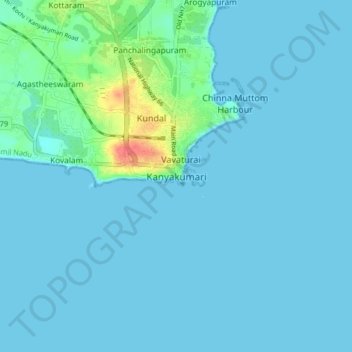
Naam: Topografische kaart Kanyakumari, hoogte, reliëf.

Locatie: Kanyakumari, Agastheeswaram, Kanniyakumari, Tamil Nadu, 629702, India (8.03925 77.50993 8.11925 77.58993)

Gemiddelde hoogte: 6 m

Minimale hoogte: 0 m

Maximale hoogte: 55 m

Rust jezelf uit voor je volgende avontuur:

🎒Wandelrugzakken - Compacte en ergonomische rugzakken voor dagtochten
🗺️Topografische Wereldkaarten - Hoogtedetail voor wereldwijde exploratie
🕶️Outdoor Zonnebrillen - UV-bescherming voor berg en zee
🦟Tekenpincetten - Verwijder teken veilig na een boswandeling
🪑Picknickdekens - Comfortabel zitten op gras of zand

Als Amazon-partner verdient deze site een commissie op in aanmerking komende aankopen, zonder extra kosten voor jou.