
Topografische kaart Oliktok Point
Interactieve kaart
Klik op de kaart om de hoogte weer te geven.
Over deze kaart
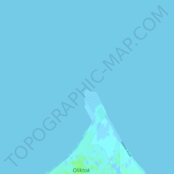
Naam: Topografische kaart Oliktok Point, hoogte, reliëf.
Locatie: Oliktok Point, North Slope, Alaska, United States (70.51297 -149.87064 70.51307 -149.87054)
Gemiddelde hoogte: 0 m
Minimale hoogte: -2 m
Maximale hoogte: 7 m
Andere topografische kaarten
Klik op een kaart om zijn topografie, zijn hoogte en zijn reliëf te bekijken.
Footprint Lake
United States > Alaska > North Slope > Utqiaġvik
Footprint Lake, Utqiaġvik, North Slope, Alaska, United States
Gemiddelde hoogte: 8 m
Point Barrow
United States > Alaska > North Slope
Point Barrow, North Slope, Alaska, United States
Gemiddelde hoogte: 0 m
Thunder Creek
United States > Alaska > North Slope
Thunder Creek, North Slope, Alaska, United States
Gemiddelde hoogte: 731 m
Wainwright
United States > Alaska > North Slope > Wainwright
Wainwright, North Slope, Alaska, 99782, United States
Gemiddelde hoogte: 3 m
Howe Island
United States > Alaska > North Slope
Howe Island, North Slope, Alaska, United States
Gemiddelde hoogte: 0 m