
Topografische kaart Saskatoon
Interactieve kaart
Klik op de kaart om de hoogte weer te geven.
Saskatoon
Saskatoon lies on a long belt of rich, potassic chernozem in middle-southern Saskatchewan and is found in the aspen parkland biome. The lack of surrounding mountainous topography gives the city a relatively flat grid, though the city does sprawl over a few hills and into a few valleys. The lowest point in the city is the river, while the highest point is disputed between the suburb of Sutherland in the east side and the Silverwood-River Heights areas in the city's north end. Saskatoon, on a cross-section from west to east, has a general decline in elevation above sea level heading towards the river, and on the east bank of the river, the terrain is mostly level until outside the city, where it begins to decrease in elevation again.
Over deze kaart
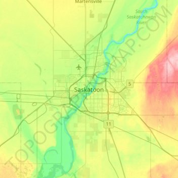
Naam: Topografische kaart Saskatoon, hoogte, reliëf.
Locatie: Saskatoon, Saskatoon (city), Saskatchewan, S7K 8E9, Canada (51.97180 -106.82077 52.29180 -106.50077)
Gemiddelde hoogte: 510 m
Minimale hoogte: 461 m
Maximale hoogte: 603 m