Geolokaliseren

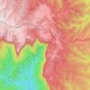
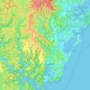
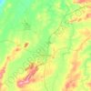
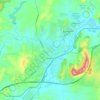
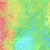
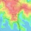
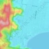
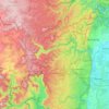
Topografische kaart Misty Mountain

Klik op de kaart om de hoogte weer te geven.

Over deze kaart

Naam: Topografische kaart Misty Mountain, hoogte, reliëf.

Locatie: Misty Mountain, Upper Lachlan Shire Council, New South Wales, Australia (-34.13288 149.58176 -34.13278 149.58186)

Gemiddelde hoogte: 780 m

Minimale hoogte: 591 m

Maximale hoogte: 906 m

Andere topografische kaarten

Klik op een kaart om zijn topografie, zijn hoogte en zijn reliëf te bekijken.
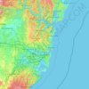
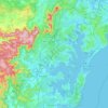
Sydney

Australia > New South Wales

Sydney's topography is characterized by a diverse landscape that seamlessly blends coastal features with inland plateaus. The city is divided into two primary regions: the relatively flat Cumberland Plain to the south and west of Sydney Harbour, and the elevated Hornsby Plateau to the north. The Cumberland…

Gemiddelde hoogte: 51 m
Newcastle

Australia > New South Wales > Newcastle

Gemiddelde hoogte: 5 m

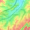
Wentworth Falls

Australia > New South Wales > Sydney

Wentworth Falls (postcode: 2782) is a town in the Blue Mountains region of New South Wales, situated approximately 100 kilometres (62 mi) west of the Sydney central business district, and about 8 kilometres (5.0 mi) east of Katoomba, Australia on the Great Western Highway, with a Wentworth Falls railway…

Gemiddelde hoogte: 708 m
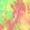
Katoomba

Australia > New South Wales

Gemiddelde hoogte: 904 m

Barrington Tops

Australia > New South Wales

Gemiddelde hoogte: 1.107 m

Sydney

Australia > New South Wales > Sydney

Gemiddelde hoogte: 23 m

Moruya

Australia > New South Wales

Gemiddelde hoogte: 37 m

Mount Druitt

Australia > New South Wales > Sydney

Gemiddelde hoogte: 52 m

Mount Pritchard

Australia > New South Wales > Sydney

Gemiddelde hoogte: 34 m

Nowra

Australia > New South Wales

Gemiddelde hoogte: 21 m

Windsor

Australia > New South Wales

Gemiddelde hoogte: 12 m

Newnes Plateau

Australia > New South Wales

Gemiddelde hoogte: 889 m

Cooma

Australia > New South Wales

Gemiddelde hoogte: 869 m

Berry

Australia > New South Wales

Gemiddelde hoogte: 38 m

Glen Innes

Australia > New South Wales

Gemiddelde hoogte: 1.083 m

Manly

Australia > New South Wales

Gemiddelde hoogte: 17 m

Erina

Australia > New South Wales

Gemiddelde hoogte: 46 m

Lismore

Australia > New South Wales

Gemiddelde hoogte: 23 m

Parramatta

Australia > New South Wales

Gemiddelde hoogte: 22 m

Wauchope

Australia > New South Wales

Gemiddelde hoogte: 32 m

Kingscliff

Australia > New South Wales

Gemiddelde hoogte: 5 m

Blue Mountains

Australia > New South Wales

A sandstone plateau dominated by a landscape of endless eucalyptus forests, the Blue Mountains are located at the top of a 470-million-year-old quartzite. In the Permian period, a shallow sea covered the region, when rivers brought shales, siltstones and mudstones. Then during the Mesozoic period, rivers…

Gemiddelde hoogte: 566 m

Stanhope

Australia > New South Wales

Gemiddelde hoogte: 146 m

Burramoko Ridge

Australia > New South Wales

Gemiddelde hoogte: 920 m

Goulburn

Australia > New South Wales

Owing to its elevation, Goulburn has an oceanic climate (Cfb) with warm summers and cool winters; with a high diurnal range. Its climate is variable much of the year, though generally dry with maximum temperatures ranging from 11.8 °C (53.2 °F) in July to 28.3 °C (82.9 °F) in January. Rainfall is…

Gemiddelde hoogte: 666 m
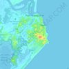
Port Macquarie

Australia > New South Wales

Gemiddelde hoogte: 5 m

Mudgee

Australia > New South Wales

Gemiddelde hoogte: 535 m

Quakers Hill

Australia > New South Wales

Gemiddelde hoogte: 35 m

Hawkesbury River

Australia > New South Wales

Gemiddelde hoogte: 130 m

Yamba

Australia > New South Wales

Gemiddelde hoogte: 2 m

Comboyne

Australia > New South Wales

Gemiddelde hoogte: 435 m

Batlow

Australia > New South Wales

Gemiddelde hoogte: 803 m

Caffreys Flat

Australia > New South Wales

Gemiddelde hoogte: 250 m

West Pennant Hills

Australia > New South Wales

Gemiddelde hoogte: 130 m

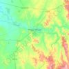
Orange

Australia > New South Wales

Orange is a city in the Central Tablelands region of New South Wales, Australia. It is 254 km (158 mi) west of the state capital, Sydney [206 km (128 mi) on a great circle], at an altitude of 862 metres (2,828 ft). Orange had an estimated urban population of 40,493 as of June 2018 making the city a significant…

Gemiddelde hoogte: 852 m
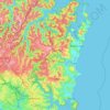
Northern Beaches

Australia > New South Wales > Sydney

Gemiddelde hoogte: 67 m

Tambaroora

Australia > New South Wales

Gemiddelde hoogte: 761 m

Kew

Australia > New South Wales

Gemiddelde hoogte: 65 m

Glenbrook

Australia > New South Wales

Gemiddelde hoogte: 168 m

Bellmount Forest

Australia > New South Wales

Gemiddelde hoogte: 658 m

Armidale

Australia > New South Wales

Gemiddelde hoogte: 1.036 m

Bowral

Australia > New South Wales

Gemiddelde hoogte: 690 m

Mount Colah

Australia > New South Wales > Sydney

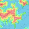
Mount Colah is 5 km north of Hornsby, the nearest major town centre. It is one of the most northerly suburbs of Sydney and is where the "Welcome to Sydney" sign is located. Mount Colah is the second highest suburb in Sydney by elevation. Considered one of Sydney's leafier suburbs, streets are clustered around…

Gemiddelde hoogte: 152 m

Glenfield

Australia > New South Wales > Sydney

Gemiddelde hoogte: 29 m

Maroubra

Australia > New South Wales

Gemiddelde hoogte: 27 m

Perisher Valley

Australia > New South Wales

Gemiddelde hoogte: 1.704 m

Collaroy

Australia > New South Wales > Sydney

Gemiddelde hoogte: 24 m

North Sydney

Australia > New South Wales > Sydney

Gemiddelde hoogte: 50 m

Illawarra

Australia > New South Wales

Gemiddelde hoogte: 234 m

Hunter River

Australia > New South Wales

Gemiddelde hoogte: 344 m

Braidwood

Australia > New South Wales

Gemiddelde hoogte: 674 m

Vacy

Australia > New South Wales

Gemiddelde hoogte: 88 m

Strathfield

Australia > New South Wales > Sydney

Gemiddelde hoogte: 26 m

Crowdy Head

Australia > New South Wales

Gemiddelde hoogte: 1 m

Turill

Australia > New South Wales

Gemiddelde hoogte: 459 m

Mount Vernon

Australia > New South Wales > Sydney

Gemiddelde hoogte: 75 m

Rhodes

Australia > New South Wales > Sydney

Gemiddelde hoogte: 6 m

Crooked Corner

Australia > New South Wales

Gemiddelde hoogte: 752 m

Mount Lewis

Australia > New South Wales > Sydney

Gemiddelde hoogte: 39 m

Mosman

Australia > New South Wales > Sydney

Gemiddelde hoogte: 29 m

Campbelltown

Australia > New South Wales

Gemiddelde hoogte: 96 m

Umina Beach

Australia > New South Wales

Gemiddelde hoogte: 38 m

Tyalgum

Australia > New South Wales

Gemiddelde hoogte: 161 m

Ocean Shores

Australia > New South Wales

Gemiddelde hoogte: 12 m

Brunswick Heads

Australia > New South Wales

Gemiddelde hoogte: 7 m

Bondi

Australia > New South Wales

Gemiddelde hoogte: 49 m

Manning River

Australia > New South Wales

Gemiddelde hoogte: 338 m

Raymond Terrace

Australia > New South Wales

Gemiddelde hoogte: 9 m

Cowra

Australia > New South Wales

Gemiddelde hoogte: 379 m

Rivertree

Australia > New South Wales

Gemiddelde hoogte: 439 m

Drake Village

Australia > New South Wales

Gemiddelde hoogte: 534 m

Georges River

Australia > New South Wales

Gemiddelde hoogte: 120 m

Nymboida

Australia > New South Wales

Gemiddelde hoogte: 280 m

Budawang Range

Australia > New South Wales

The highest mountain in the range is Mount Budawang, which has an elevation of 1,129 metres (3,704 ft) above sea level.

Gemiddelde hoogte: 484 m

Darlington Point

Australia > New South Wales

Gemiddelde hoogte: 126 m

Fingal Bay

Australia > New South Wales

Gemiddelde hoogte: 13 m

Bemboka

Australia > New South Wales

Gemiddelde hoogte: 542 m

Wingello

Australia > New South Wales

Gemiddelde hoogte: 607 m

Paterson

Australia > New South Wales

Gemiddelde hoogte: 98 m

Nashua

Australia > New South Wales

Gemiddelde hoogte: 61 m

Townsend

Australia > New South Wales

Gemiddelde hoogte: 19 m

Narrandera

Australia > New South Wales

Gemiddelde hoogte: 164 m

Lord Howe Island

Australia > New South Wales

Gemiddelde hoogte: 27 m

Yaouk

Australia > New South Wales

Gemiddelde hoogte: 1.326 m

Tuross Head

Australia > New South Wales

Gemiddelde hoogte: 6 m

Byron Bay

Australia > New South Wales

Byron Bay, located in northeastern New South Wales, Australia, is characterized by diverse topography shaped by its geological history. The town is part of the erosion caldera of the ancient Tweed Volcano, which erupted approximately 23 million years ago, resulting in the rich volcanic soils that define the…

Gemiddelde hoogte: 7 m

Rust jezelf uit voor je volgende avontuur:

🪢Wandelstokken - Extra stabiliteit en comfort tijdens het wandelen
🔔Noodfluitjes - Essentieel veiligheidsaccessoire
🥾Wandelschoenen Dames - Lichte en stabiele wandelschoenen voor lange wandeltochten
🎒Heuptasjes - Houd je smartphone en kaart binnen handbereik
🗺️Topografische Kaarten - Gedetailleerde topografische kaarten voor wandelen, trekking en oriëntatie

Als Amazon-partner verdient deze site een commissie op in aanmerking komende aankopen, zonder extra kosten voor jou.