
Topografische kaart Monroe
Interactieve kaart
Klik op de kaart om de hoogte weer te geven.
Over deze kaart
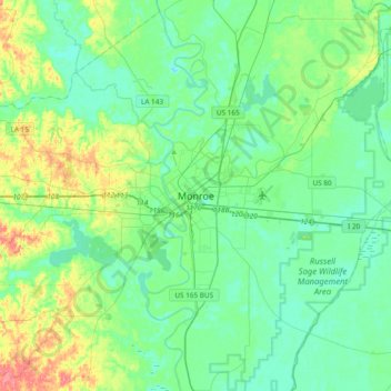
Naam: Topografische kaart Monroe, hoogte, reliëf.
Locatie: Monroe, Ouachita Parish, Louisiana, 71201, United States (32.35024 -92.26324 32.67024 -91.94324)
Gemiddelde hoogte: 27 m
Minimale hoogte: 10 m
Maximale hoogte: 78 m
Located in northeastern Louisiana, Monroe is the center of the Monroe metropolitan statistical area. It is the parish seat of Ouachita Parish, and northeastern Louisiana's economic and cultural hub. Monroe has an elevation of 72 feet (21.9 m) above sea level. According to the United States Census Bureau, the city has a total area of 31.6 square miles (83.9 km2), of which, 28.7 square miles (74.3 km2) of it is land and 3.7 square miles (9.6 km2) of it is water; the total area is 11.46% water.