
Topografische kaart Rivière L'Assomption
Interactieve kaart
Klik op de kaart om de hoogte weer te geven.
Over deze kaart
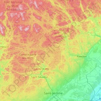
Naam: Topografische kaart Rivière L'Assomption, hoogte, reliëf.
Gemiddelde hoogte: 330 m
Minimale hoogte: 9 m
Maximale hoogte: 917 m
Andere topografische kaarten
Klik op een kaart om zijn topografie, zijn hoogte en zijn reliëf te bekijken.
Parc Jacques-Cartier
Canada > Québec > L'Assomption (MRC) > L'Assomption
Parc Jacques-Cartier, L'Assomption, L'Assomption (MRC), Lanaudière, Québec, Canada
Gemiddelde hoogte: 17 m