
Topografische kaart Uniontown
Klik op de kaart om de hoogte weer te geven.
Over deze kaart
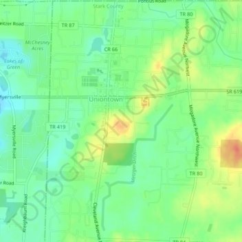
Naam: Topografische kaart Uniontown, hoogte, reliëf.
Locatie: Uniontown, Lake Township, Stark County, Ohio, United States (40.95750 -81.41750 40.98853 -81.39158)
Gemiddelde hoogte: 346 m
Minimale hoogte: 326 m
Maximale hoogte: 378 m
Andere topografische kaarten
Klik op een kaart om zijn topografie, zijn hoogte en zijn reliëf te bekijken.