
Topografische kaart Ponchatoula
Interactieve kaart
Klik op de kaart om de hoogte weer te geven.
Ponchatoula
Ponchatoula is located at 30°26′21″N 90°26′33″W / 30.43917°N 90.44250°W / 30.43917; -90.44250 (30.439162, -90.442507) and has an elevation of 26 feet (7.9 m). According to the United States Census Bureau, the city has a total area of 4.2 square miles (11 km2), all land.
Over deze kaart
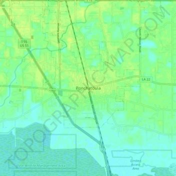
Naam: Topografische kaart Ponchatoula, hoogte, reliëf.
Gemiddelde hoogte: 7 m
Minimale hoogte: 1 m
Maximale hoogte: 14 m