
Topografische kaart Cirencester
Klik op de kaart om de hoogte weer te geven.
Cirencester
On Cotswold Avenue is the site of a Roman amphitheatre which, while buried, retains its shape in the earthen topography of the small park setting. Cirencester was one of the most substantial cities of Roman-era Britain.
Over deze kaart
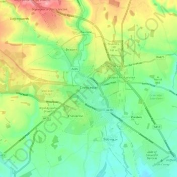
Naam: Topografische kaart Cirencester, hoogte, reliëf.
Gemiddelde hoogte: 128 m
Minimale hoogte: 89 m
Maximale hoogte: 194 m