
Topografische kaart Ferreries
Interactieve kaart
Klik op de kaart om de hoogte weer te geven.
Ferreries
Ferreries is a municipality on the island of Menorca, in the Spanish autonomous community of the Balearic Islands. Its name is derived from the Catalan word ferrer ("blacksmith"), which in turn, comes from Latin word ferrum. At an elevation of 150 metres it is the island's highest town. Plaça Espanya
Over deze kaart
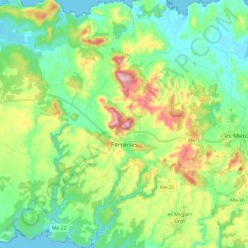
Naam: Topografische kaart Ferreries, hoogte, reliëf.
Locatie: Ferreries, Menorca, Balearic Islands, 07750, Spain (39.92902 3.95743 40.05963 4.06378)
Gemiddelde hoogte: 82 m
Minimale hoogte: 0 m
Maximale hoogte: 268 m