
Topografische kaart Oxbow Nature Study Area
Interactieve kaart
Klik op de kaart om de hoogte weer te geven.
Over deze kaart
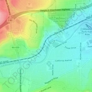
Naam: Topografische kaart Oxbow Nature Study Area, hoogte, reliëf.
Gemiddelde hoogte: 1.415 m
Minimale hoogte: 1.377 m
Maximale hoogte: 1.500 m
Andere topografische kaarten
Klik op een kaart om zijn topografie, zijn hoogte en zijn reliëf te bekijken.
Valley Wood Park
United States > Nevada > Washoe County > Reno
Valley Wood Park, 6555, Reno, Washoe County, Nevada, 89523, United States
Gemiddelde hoogte: 1.546 m
North Valley
United States > Nevada > Washoe County > Reno
North Valley, Reno, Washoe County, Nevada, 89512, United States
Gemiddelde hoogte: 1.419 m