
Topografische kaart Dunstable
Interactieve kaart
Klik op de kaart om de hoogte weer te geven.
Over deze kaart
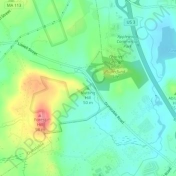
Naam: Topografische kaart Dunstable, hoogte, reliëf.
Gemiddelde hoogte: 60 m
Minimale hoogte: 34 m
Maximale hoogte: 118 m
Andere topografische kaarten
Klik op een kaart om zijn topografie, zijn hoogte en zijn reliëf te bekijken.
Hopkinton Reservoir
United States > Massachusetts > Middlesex County > Hopkinton
Gemiddelde hoogte: 111 m
Freeman Lake
United States > Massachusetts > Middlesex County > Chelmsford > North Chelmsford
Gemiddelde hoogte: 40 m
Waitts Mount
United States > Massachusetts > Middlesex County > Malden > Malden Centre
Gemiddelde hoogte: 22 m
Lake Mascuppic
United States > Massachusetts > Middlesex County > Tyngsborough > Willowdale
Gemiddelde hoogte: 57 m
Maynard
United States > Massachusetts > Middlesex County
According to the United States Census Bureau, the town has a total area of 5.4 square miles (13.9 km²), of which 5.2 square miles (13.6 km²) is land and 0.1 square miles (0.3 km²), or 2.42%, is water. Average elevation is roughly 200 feet (~61 m) above sea level; the highest point is Summer Hill, elevation…
Gemiddelde hoogte: 65 m
Ashby
United States > Massachusetts > Middlesex County
Mount Watatic was also once home to state fire tower #31 that looked out over central Massachusetts at an elevation above sea level of 1590 FT. Phone lines to the tower ran up the Ashby and Ashburnham sides of the mountain over the years.
Gemiddelde hoogte: 265 m
Stow
United States > Massachusetts > Middlesex County
On New Year's Day, 1984, Kevin Walsh took off from Minute Man Air Field with 57 helium balloons tied to a lawn chair, later descending by parachute. He was cited with four violations of FAA regulations and fined $4,000 ($10,922.66 adjusted for inflation to 2022). He reached an altitude of 9,000 feet (2,700 m).
Gemiddelde hoogte: 72 m
Bridge Meadow Brook
United States > Massachusetts > Middlesex County > Tyngsborough
Gemiddelde hoogte: 60 m