Geolokaliseren

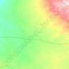
Topografische kaart Great Wall

Klik op de kaart om de hoogte weer te geven.

Over deze kaart

Naam: Topografische kaart Great Wall, hoogte, reliëf.

Locatie: Great Wall, Cloncurry Shire, Queensland, Australia (-20.98701 139.98810 -20.98691 139.98820)

Gemiddelde hoogte: 354 m

Minimale hoogte: 323 m

Maximale hoogte: 426 m

Andere topografische kaarten

Klik op een kaart om zijn topografie, zijn hoogte en zijn reliëf te bekijken.
Brisbane River

Australia > Queensland

The RAAF also perform a practice session in the days preceding the event, serving as an opportunity to both practice beforehand and also promote Riverfire. One of the most popular RAAF aircraft to perform at Riverfire was the F-111 which was known for performing a 'dump-and-burn' above the city. The final…

Gemiddelde hoogte: 235 m
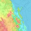
City of Brisbane

Australia > Queensland

Brisbane's topography is characterized by a series of hills and ranges that define its landscape. The city is situated on a low-lying floodplain, with the Brisbane River meandering through its heart, creating a winding course with many steep curves from the southwest to its mouth at Moreton Bay in the east.…

Gemiddelde hoogte: 71 m

Kobble Creek

Australia > Queensland

Gemiddelde hoogte: 239 m

D'Aguilar National Park

Australia > Queensland

Gemiddelde hoogte: 139 m

Wongawallan

Australia > Queensland

Gemiddelde hoogte: 185 m

Upper Coomera

Australia > Queensland

Gemiddelde hoogte: 43 m

Byfield National Park

Australia > Queensland

Gemiddelde hoogte: 42 m

Cedar Creek

Australia > Queensland

Gemiddelde hoogte: 116 m

Brisbane

Australia > Queensland

Gemiddelde hoogte: 87 m

Mount Warren Park

Australia > Queensland

Gemiddelde hoogte: 18 m

Giru

Australia > Queensland

Gemiddelde hoogte: 5 m

Scenic Rim Regional

Australia > Queensland

Gemiddelde hoogte: 261 m

Parkwood

Australia > Queensland > Gold Coast City

Gemiddelde hoogte: 26 m

Moorooka

Australia > Queensland > Brisbane City

Gemiddelde hoogte: 27 m

Molendinar

Australia > Queensland > Gold Coast City

Gemiddelde hoogte: 27 m

Walloon

Australia > Queensland > Ipswich City

Gemiddelde hoogte: 50 m

Barron River

Australia > Queensland > Kuranda

The Barron's headwaters start in the Mount Hypipamee National Park near Mount Hypipamee at an elevation of 1,200 metres (3,900 ft). The river then flows north 65 kilometres (40 mi) across the Atherton Tablelands before finally turning east after Mareeba towards Kuranda. After passing under the Kuranda Range…

Gemiddelde hoogte: 360 m

Paddys Green

Australia > Queensland

Gemiddelde hoogte: 518 m

Toogoom

Australia > Queensland

Gemiddelde hoogte: 5 m

Byfield

Australia > Queensland

Gemiddelde hoogte: 100 m

Wivenhoe Dam

Australia > Queensland

Gemiddelde hoogte: 62 m

Noosaville

Australia > Queensland

Gemiddelde hoogte: 9 m

Lockyer Valley Regional

Australia > Queensland

Gemiddelde hoogte: 360 m

Mount Coot-tha

Australia > Queensland > City of Brisbane

It is often claimed that Mount Coot-tha is the "highest point in Brisbane", but, as the elevations above show, the peak known as Mount Coot-tha is not even the highest peak of the mountain as a whole with both Constitution Hill and The Summit being higher. However, Mount Coot-tha has a lookout with unobscured…

Gemiddelde hoogte: 88 m

Spring Hill

Australia > Queensland

Gemiddelde hoogte: 25 m

Capalaba

Australia > Queensland

Gemiddelde hoogte: 29 m

Fig Tree Pocket

Australia > Queensland

Gemiddelde hoogte: 20 m

Whitsundays

Australia > Queensland

Gemiddelde hoogte: 15 m

Nudgee

Australia > Queensland

Gemiddelde hoogte: 7 m

Upper Caboolture

Australia > Queensland

Gemiddelde hoogte: 32 m

Highfields

Australia > Queensland

Along with Meringandan, the climate is oceanic (Köppen: Cfb) due to elevation, usually located further south of Australia.

Gemiddelde hoogte: 589 m

Miva

Australia > Queensland

Gemiddelde hoogte: 58 m

Tamborine Mountain

Australia > Queensland

Gemiddelde hoogte: 241 m

Crestmead

Australia > Queensland

Gemiddelde hoogte: 30 m

Samford Valley

Australia > Queensland

Gemiddelde hoogte: 109 m

Macleay Island

Australia > Queensland

Gemiddelde hoogte: 2 m

Ningi

Australia > Queensland

Gemiddelde hoogte: 6 m

Springsure

Australia > Queensland

Gemiddelde hoogte: 390 m

Redcliffe

Australia > Queensland

Gemiddelde hoogte: 9 m

Sunshine Coast Regional

Australia > Queensland

The Sunshine Coast Regional area in Queensland, Australia, features a diverse topography that ranges from coastal plains to rugged hinterlands. Along the coastline, the terrain is predominantly flat, with average elevations around 20 meters (66 feet) above sea level. Inland, the landscape transitions to…

Gemiddelde hoogte: 56 m

Robertson

Australia > Queensland

Gemiddelde hoogte: 59 m

Eatons Hill

Australia > Queensland

Gemiddelde hoogte: 52 m

Dulacca

Australia > Queensland

Gemiddelde hoogte: 328 m

Rosalie Plains

Australia > Queensland

Gemiddelde hoogte: 467 m

Banks Street Reserve

Australia > Queensland > Brisbane

Gemiddelde hoogte: 33 m

Little Mulgrave

Australia > Queensland

Gemiddelde hoogte: 271 m

Coochiemudlo Island

Australia > Queensland

Gemiddelde hoogte: 2 m

North Maleny

Australia > Queensland > Maleny

Gemiddelde hoogte: 326 m

Collinsville

Australia > Queensland

Gemiddelde hoogte: 197 m

Davies Park

Australia > Queensland

Gemiddelde hoogte: 16 m

Eildon Hill Reserve

Australia > Queensland

Gemiddelde hoogte: 21 m

Great Dividing Range

Australia > Queensland

Gemiddelde hoogte: 939 m

Ilbilbie

Australia > Queensland

Gemiddelde hoogte: 59 m

Trebonne

Australia > Queensland

Gemiddelde hoogte: 19 m

Richmond Shire

Australia > Queensland

Gemiddelde hoogte: 269 m

Southern Downs Regional

Australia > Queensland

Gemiddelde hoogte: 594 m

Cooroibah

Australia > Queensland

Gemiddelde hoogte: 13 m

Burpengary

Australia > Queensland

Gemiddelde hoogte: 26 m

Sippy Downs

Australia > Queensland

Gemiddelde hoogte: 12 m

Redland City

Australia > Queensland

Gemiddelde hoogte: 19 m

Cairns Regional

Australia > Queensland

Gemiddelde hoogte: 328 m

Runnymede

Australia > Queensland

Gemiddelde hoogte: 402 m

Great Sandy Strait

Australia > Queensland

There are numerous named and unnamed islands in the strait. The named island are from north to south: Big Woody Island, Round Island, Little Woody Island, Picnic Island, Duck Island, Walsh Island, Turkey Island, Bookar Island, Thomas Island, Slain Island, Tooth Island, Round Bush Island, New Island, Garden…

Gemiddelde hoogte: 28 m

Dayboro

Australia > Queensland

Gemiddelde hoogte: 85 m

Highland Park

Australia > Queensland > Gold Coast City

Gemiddelde hoogte: 47 m

Yarrabilba

Australia > Queensland

Gemiddelde hoogte: 63 m

Maranoa Regional

Australia > Queensland

Gemiddelde hoogte: 369 m

West Prairie

Australia > Queensland

Gemiddelde hoogte: 363 m

Ravensbourne

Australia > Queensland

Gemiddelde hoogte: 528 m

Gayndah

Australia > Queensland

Gemiddelde hoogte: 153 m

Waterford West

Australia > Queensland

Gemiddelde hoogte: 14 m

Nambour

Australia > Queensland

Gemiddelde hoogte: 41 m

Maleny

Australia > Queensland

Gemiddelde hoogte: 389 m

Hillcrest

Australia > Queensland

Gemiddelde hoogte: 56 m
Carneys Creek

Australia > Queensland

Gemiddelde hoogte: 479 m

Sunshine Beach

Australia > Queensland

Gemiddelde hoogte: 26 m

Blackbutt

Australia > Queensland

Gemiddelde hoogte: 450 m

Mornington Island

Australia > Queensland

The general topography of the island, which lies on the eastern (Queensland) side of the Gulf of Carpentaria, is flat with the maximum elevation of 150 metres (490 ft). The island is fringed by mangrove forests and contains 10 estuaries, all in near pristine condition.

Gemiddelde hoogte: 3 m

Upper Mount Gravatt

Australia > Queensland

Gemiddelde hoogte: 61 m

Rothwell

Australia > Queensland

Gemiddelde hoogte: 5 m

Eli Waters

Australia > Queensland > Hervey Bay

Gemiddelde hoogte: 3 m

Cinnabar

Australia > Queensland

Gemiddelde hoogte: 264 m

Wellington Point

Australia > Queensland > Brisbane

Gemiddelde hoogte: 7 m

Banyo

Australia > Queensland

Gemiddelde hoogte: 8 m

Birkdale

Australia > Queensland

Gemiddelde hoogte: 13 m

Mount Archer

Australia > Queensland

Gemiddelde hoogte: 223 m

Leyburn

Australia > Queensland > Leyburn

Gemiddelde hoogte: 441 m

Stanthorpe

Australia > Queensland

Owing to its elevation, Stanthorpe features a subtropical highland climate (Cfb). At an altitude of 811 metres (2,661 ft), Stanthorpe holds the record for the lowest temperature recorded in Queensland at −10.6 °C (12.9 °F) on 23 June 1961.

Gemiddelde hoogte: 831 m

Kuranda

Australia > Queensland

Gemiddelde hoogte: 389 m

Girraween

Australia > Queensland

Gemiddelde hoogte: 1.000 m

Draper

Australia > Queensland

Gemiddelde hoogte: 65 m

Kenilworth

Australia > Queensland

Gemiddelde hoogte: 386 m

Ballandean

Australia > Queensland

Gemiddelde hoogte: 830 m

Norman Creek

Australia > Queensland

Gemiddelde hoogte: 13 m

Cooktown

Australia > Queensland

Gemiddelde hoogte: 144 m

Kuttabul

Australia > Queensland

Gemiddelde hoogte: 92 m

Rust jezelf uit voor je volgende avontuur:

💧Herbruikbare Waterflessen - Hydratatie voor onderweg, milieuvriendelijk en licht
🔋Outdoor Powerbanks - Laad je smartphone of GPS op in de natuur
🧥Outdoor Winterjassen - Isolatie voor koude wandeltochten
📦Waterdichte Tassen - Bescherming voor elektronica en kaarten
📏Afstandsmeters - Meet afstanden op kaart en terrein

Als Amazon-partner verdient deze site een commissie op in aanmerking komende aankopen, zonder extra kosten voor jou.