
Topografische kaart Mettmenstetten
Interactieve kaart
Klik op de kaart om de hoogte weer te geven.
Mettmenstetten
The municipality includes the village of Mettmenstetten, with the two core sections of Ober- and Untermettmenstetten as well as the other sections; Dachlissen, Eigi, Grossholz, Herferswil, Hübscheren, Rossau and Wissenbach. It is located an elevation of 460 m (1,510 ft).
Over deze kaart
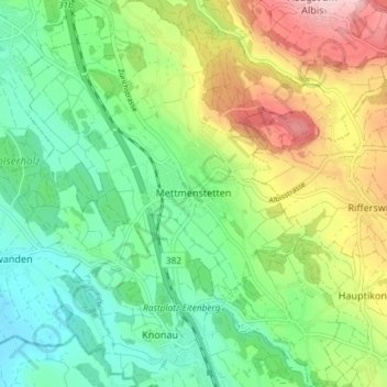
Naam: Topografische kaart Mettmenstetten, hoogte, reliëf.
Locatie: Mettmenstetten, Bezirk Affoltern, Zurich, 8932, Switzerland (47.21838 8.43208 47.26832 8.50067)
Gemiddelde hoogte: 506 m
Minimale hoogte: 389 m
Maximale hoogte: 727 m
Andere topografische kaarten
Klik op een kaart om zijn topografie, zijn hoogte en zijn reliëf te bekijken.