
Topografische kaart Española
Interactieve kaart
Klik op de kaart om de hoogte weer te geven.
Española
Española lies at an elevation of around 5,595 feet (1,705 m) with much variance. It is in a valley nestled between the Jemez and Sangre de Cristo mountain ranges, and the meeting point of three rivers, the Rio Grande, the Rio Chama, and the Rio Santa Cruz.
Over deze kaart
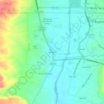
Naam: Topografische kaart Española, hoogte, reliëf.
Gemiddelde hoogte: 1.722 m
Minimale hoogte: 1.696 m
Maximale hoogte: 1.794 m