
Topografische kaart Zouch
Interactieve kaart
Klik op de kaart om de hoogte weer te geven.
Over deze kaart
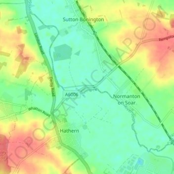
Naam: Topografische kaart Zouch, hoogte, reliëf.
Gemiddelde hoogte: 49 m
Minimale hoogte: 26 m
Maximale hoogte: 83 m
Most of the hamlet lies in the civil parish of Sutton Bonington, apart from Zouch Farm which falls within Normanton on Soar parish, and the part in Leicestershire which is in Hathern parish. The nearest town is Loughborough. The A6006 road passes through the hamlet and crosses the Soar on Zouch Bridge (alternatively "County Bridge" as it spans the county border). The elevation of Zouch is 30 metres (98 ft).