
Topografische kaart Gajwel
Interactieve kaart
Klik op de kaart om de hoogte weer te geven.
Gajwel
The town is located on the Deccan Plateau and is surrounded by agricultural lands. It lies at an average elevation of around 540 meters (1,770 feet) above sea level. The area is characterized by undulating terrain with scattered hills and valleys.
Over deze kaart
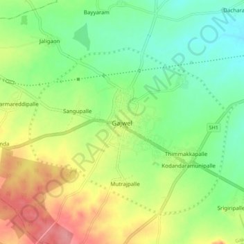
Naam: Topografische kaart Gajwel, hoogte, reliëf.
Gemiddelde hoogte: 568 m
Minimale hoogte: 532 m
Maximale hoogte: 620 m