
Topografische kaart Ohiwa
Interactieve kaart
Klik op de kaart om de hoogte weer te geven.
Over deze kaart
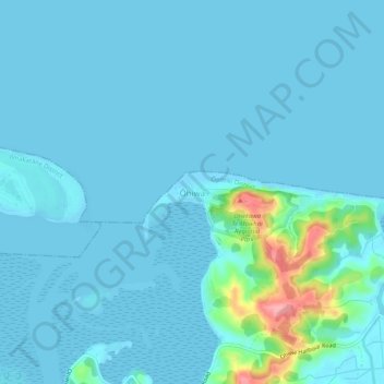
Naam: Topografische kaart Ohiwa, hoogte, reliëf.
Locatie: Ohiwa, Ōpōtiki District, Bay of Plenty, Nieuw-Zeeland (-38.00876 177.13937 -37.96876 177.17937)
Gemiddelde hoogte: 11 m
Minimale hoogte: 0 m
Maximale hoogte: 115 m