Geolokaliseren

Topografische kaart Little Darby Island

Interactieve kaart

Klik op de kaart om de hoogte weer te geven.

Over deze kaart

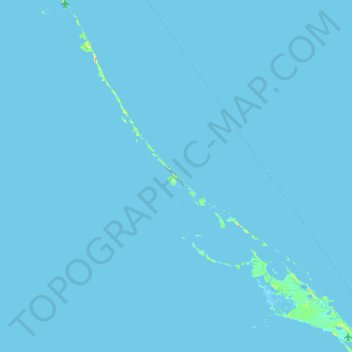
Naam: Topografische kaart Little Darby Island, hoogte, reliëf.

Locatie: Little Darby Island, Exuma, The Bahamas (23.53527 -76.53830 24.17527 -75.89830)

Gemiddelde hoogte: 0 m

Minimale hoogte: -1 m

Maximale hoogte: 36 m

Andere topografische kaarten

Klik op een kaart om zijn topografie, zijn hoogte en zijn reliëf te bekijken.

Great Exuma Island

The Bahamas > Exuma

Great Exuma Island, Exuma, The Bahamas

Gemiddelde hoogte: 1 m

Darby Island

The Bahamas > Exuma

Darby Island, Exuma, The Bahamas

Gemiddelde hoogte: 2 m

Little Halls Pond Cay

The Bahamas > Exuma

Little Halls Pond Cay, Exuma, The Bahamas

Gemiddelde hoogte: 0 m

Lee Stocking Island

The Bahamas > Exuma

Lee Stocking Island, Exuma, The Bahamas

Gemiddelde hoogte: 1 m

Staniel Cay

The Bahamas > Exuma

Staniel Cay, Exuma, The Bahamas

Gemiddelde hoogte: 2 m

Bock Cay

The Bahamas > Exuma

Bock Cay, Exuma, The Bahamas

Gemiddelde hoogte: 1 m