
Topografische kaart གངས་རིན་པོ་ཆེ 冈仁波齐 Kailash
Interactieve kaart
Klik op de kaart om de hoogte weer te geven.
གངས་རིན་པོ་ཆེ 冈仁波齐 Kailash
Kailash (ook Kailas, Kailasa of Kangrinbogê Feng), op 6718,2 m hoogte, is de bron van de langste rivieren van India: de Indus, de Sutlej en de Brahmapoetra. De berg ligt bij het meer van Manasarowar en het meer van Rakshastal in Tibet. De berg is te bereiken via de nationale weg G219.
Over deze kaart
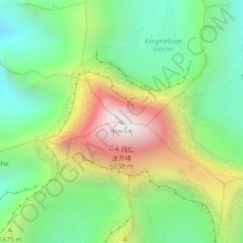
Naam: Topografische kaart གངས་རིན་པོ་ཆེ 冈仁波齐 Kailash, hoogte, reliëf.
Gemiddelde hoogte: 5.748 m
Minimale hoogte: 5.275 m
Maximale hoogte: 6.585 m