Topografische kaart 那曲市 ནག་ཆུ།
Interactieve kaart
Klik op de kaart om de hoogte weer te geven.
Over deze kaart
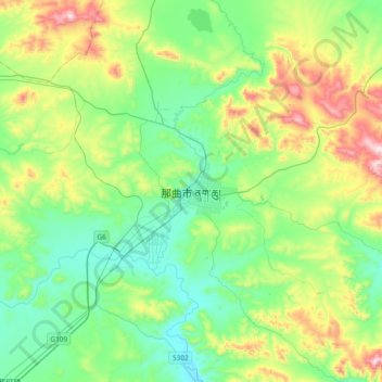
Naam: Topografische kaart 那曲市 ནག་ཆུ།, hoogte, reliëf.
Gemiddelde hoogte: 4.624 m
Minimale hoogte: 4.452 m
Maximale hoogte: 5.065 m

Klik op de kaart om de hoogte weer te geven.
Naam: Topografische kaart 那曲市 ནག་ཆུ།, hoogte, reliëf.
Gemiddelde hoogte: 4.624 m
Minimale hoogte: 4.452 m
Maximale hoogte: 5.065 m