
Topografische kaart Rishikesh
Klik op de kaart om de hoogte weer te geven.
Over deze kaart
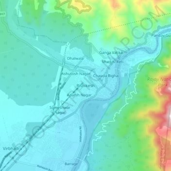
Naam: Topografische kaart Rishikesh, hoogte, reliëf.
Locatie: Rishikesh, Dehradun, Uttarakhand, 249201, India (30.06865 78.25162 30.14865 78.33162)
Gemiddelde hoogte: 497 m
Minimale hoogte: 323 m
Maximale hoogte: 1.363 m