Topografische kaart 山南市 ལྷོ་ཁ།
Interactieve kaart
Klik op de kaart om de hoogte weer te geven.
Over deze kaart
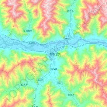
Naam: Topografische kaart 山南市 ལྷོ་ཁ།, hoogte, reliëf.
Gemiddelde hoogte: 4.148 m
Minimale hoogte: 3.542 m
Maximale hoogte: 5.430 m

Klik op de kaart om de hoogte weer te geven.
Naam: Topografische kaart 山南市 ལྷོ་ཁ།, hoogte, reliëf.
Gemiddelde hoogte: 4.148 m
Minimale hoogte: 3.542 m
Maximale hoogte: 5.430 m